"I am not one who was born in the custody of wisdom. I am one who is fond of olden times and intense in quest of the sacred knowing of the ancients." Gustave Courbet
Showing posts with label Bodleian. Show all posts

14 July 2026

Marvellous.


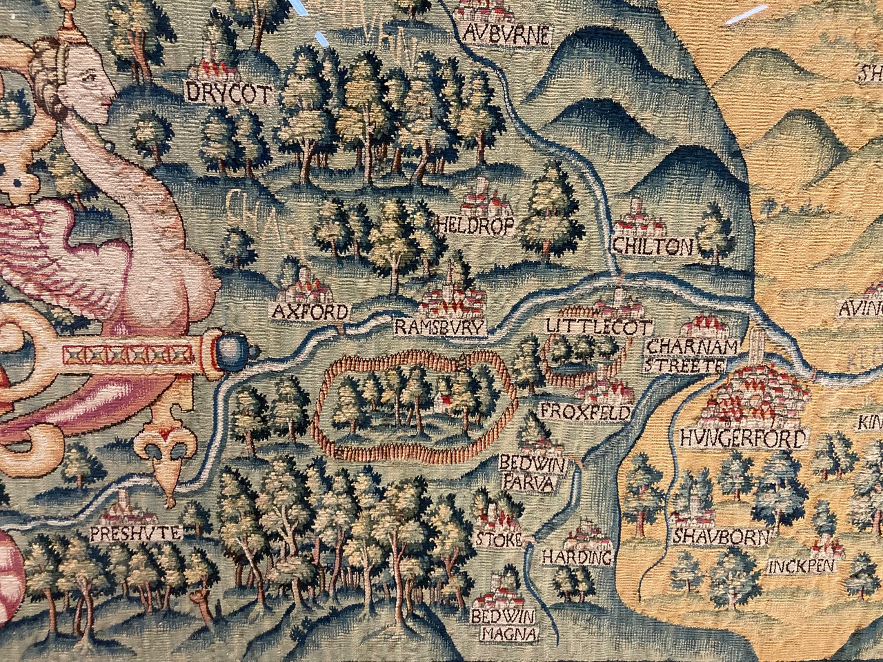
The Bodleian Map Room has the Oxfordshire Sheldon tapestry ...
Made from a mix of wool and silk the tapestries are both marvellous in their own right but are also important cartographic records, made at a time when England was beginning to be mapped properly for the first time. Each one would have originally measured approximately 15 by 20 feet and each has a "featured" county at its centre, bordered in red. Rivers and settlements feature prominently as do scenes of local interest such as the Rollright Stones, a prehistoric stone circle in north Oxfordshire, or a brief bit of text on the Worcestershire tapestry telling of a land slip. Important houses are shown though none as big as Sheldon’s, Weston House, which appears on all four tapestries, the very centre of the area the tapestries show. And what an area, when put together as a set of maps the range goes from as far north as the suburbs of Birmingham down past a beautiful, though comically inaccurate, White Horse at Uffington and from the Welsh border across to the Tower of London the whole of central England is depicted in glorious detail.

24 January 2026

Know.

Hollis/Buckler, Bodleian Library, Oxford, n/d


It hardly matters why a library is destroyed: every banning, curtailment, shredding, plunder or loot gives rise (at least as a ghostly presence) to a louder, clearer, more durable library of the banned, looted, plundered, shredded or curtailed.

Readers, censors know, are defined by the books they read.

Alberto Manguel, from The Library at Night

26 December 2025

Internal.

Homann, Danish Part of Norway, the Great Diocese of Akershus, 1729


Bodleian Map Room explores a unique Nordic mine map ...
This map shows the county of Akershus in Norway, centred around Christiania (now Oslo), in the eighteenth century. The map was drawn by Johann Baptist Homann, a largely self taught cartographer and engraver, in 1729. The area is described by a Latinized version of its name, Aggerhusiensis. About a quarter of the map is taken up by an illustration of a mine, with the surface cut away to show the internal workings.
Geographicus Rare Antique Maps has more, HERE.

18 November 2025

Propagate.

Bodley, Bodleian Library, 1602


Who looks upon a river in a meditative hour, and is not reminded of the flux of all things? Throw a stone into the stream, and the circles that propagate themselves are the beautiful type of all influence.

Ralph Waldo Emerson, from Nature

18 October 2025

On.


The stories that unfold in the space of a writer's study, the objects chosen to watch over a desk, the books selected to sit on the shelves, all weave a web of echoes and reflections of meanings and affections, that lend a visitor the illusion that something of the owner of this space lives on between these walls, even if the owner is no more.

Alberto Manguel, from The Library at Night

28 May 2025

De-Duplication.


The Bodleian Map Room on de-duplication ...
The Bodleian Library’s catalogues have a complicated history. New acquisitions are of course catalogued online and appear straight away on the online catalogue, SOLO. However, the collections have been acquired over the centuries and earlier records were made on index cards, in printed volumes and even as handwritten records. Over the years, these earlier records have been converted into online records, but the information is not always as comprehensive as it would be if we acquired the item now and catalogued it to modern standards.

So when we occasionally discover that we have two duplicate records for the same thing, and that it’s been in our collections for over 200 years, this isn’t particularly surprising and can usually be tidied up quickly. A recent case proved more intriguing ...

There's a long history of inverting the "A" ... 

22 February 2025

Fencing.


The Bodleian has fencing maps ...
In Robert Frost’s poem "Mending Wall" two neighbours walk the shared boundaries of their properties, checking on the condition of the wall separating their land and making repairs where necessary. At one point the narrator teases his neighbour on the need for the wall, “My apple trees will never come across and eat the cones under his pines, I tell him”. The neighbour replies, simply and memorably, “Good fences make good neighbours”.

Frost loves the phrase so much that it’s repeated again, to close the poem, and I’m reminded of this when looking at these two estate maps, of Down Manor from 1718 and Mowden Hall, 1762, both in Essex. Both are typical examples of an estate plan, are in manuscript form and show the holdings and field names of each estate (with sizes in acres, roods and perches). The connection with Frost comes with both showing boundaries in two different colours, according to ownership and according to responsibility of maintenance, to mark the outer boundaries of each estate. Any boundary dispute in the future would be easily settled with reference to the map. The importance of boundary fences are obvious, the need to keep animals out of certain fields and in others, as a way of separating good land from not so good and as a way of marking the limit of your land from your neighbour. The Down Manor map nicely calls the fencing surrounding the property "Out fencing."

14 November 2023

Full.
Another gem from The Bodleian Map Room ...
William Grent made the first version of this beautifully elaborate and descriptive double hemisphere World map in 1625. Little is known about Grent and there are no other listings for any work apart from his World map, which went on to be copied and improved on a number of times. John Speed used it as the basis for his World map published in his "A Prospect of the most Famous Parts of the World" atlas a year later while Thomas Jenner, publisher, bookseller and engraver, produced copies in 1632 and, the date of this copy, 1641.

It is a map so full of information, iconography and allegory that it is hard to know where to start. It may not be the best topographically – it’s one of the first to show California as an island despite numerous examples both before and after showing the location as a peninsula – but is still full of useful information about places. "At the Cape of Good Hope all that passe to and from the East Indies ancour to take in fresh vittaile and meete newes one of another affaires" (a blog about "rounding the Horn" can be found here) and in another part of the map we’re told that "This south land undiscovered commonly known as Terra Australis…can not certainly be affirmed…only some few coasts thereof have appeared to sea men driven there upon by extremity of weather…"

08 September 2023

Lovely.

Today's rabbit hole finds us wandering through The Bodleian Library's Map Room ...
At twenty minutes to two on the afternoon of the 8th September 1785 Mr Thomas Baldwin, to the ‘tears of delight and apprehension, the misgivings of humanity, and other sensations of surprize’ of the inhabitants of Chester took flight in a hot air balloon. Ascending to a height of four miles over Chester Baldwin was able to look down on the earth, a true birds-eye view. He wrote of his adventures in a book published the following year, Airopaidia : or aerial recreation, describing the voyage as well as giving a detailed account of the preparation involved in the flight (for instance a canon was fired at 7 am to let people know that the balloon was being inflated), the equipment taken onboard (as well as ballast brandy and feathers to throw out at various times to check wind speed and direction), and, rather worryingly, what to do if you start to descend too quickly. Baldwin also included some lovely original maps showing the views from above the clouds ...

Chester, A Balloon Prospect from Above the Clouds, 1786

24 January 2023

Gas.


Oxford's Radcliffe Camera ...
Although the building was completed in 1748, a librarian appointed, and also a porter, who was to be equipped with a gown and a staff and have a salary of £20 per annum, the opening ceremony did not take place until 13 April 1749. The new library was from the first known as the Physic Library, 'being to consist of all Sorts of Books belonging to the Science of Physic, as Anatomy, Botany, Surgery, and Philosophy', but the accessions it received during the first sixty years of its existence bore little relation to this description, and it was not until 1811 that its intake was confined to works of a scientific nature. Accessions to the library did not, however, consist entirely of books. During the first half of the 19th century it became the home for coins, marbles, candelabra, busts, plaster casts, and statues, but in recent years most of these have been placed in other repositories more suited to their proper care and display.

The basement story was originally an open arcade with a vaulted stone ceiling, bearing in the centre Radcliffe's coat of arms. The arches of the arcade were filled by iron grilles, three of which were in the form of gates which were closed at night, and through which access was gained to the library by way of the grand staircase. These grilles still remain. The glazing of the arches, the construction of a new north entrance where once was a circular window, and the addition of the stone steps leading up to it, were carried out in 1863 when the building had become a reading-room of the Bodleian. In 1854 the library was, for the first time, properly warmed and lighted. Hitherto a very indifferent system of lighting and heating the gallery by gas had been in operation since 1835. Between 1909 and 1912 an underground bookstore of two floors was constructed beneath the north lawn of the library, and a tunnel connecting it with the Bodleian, thus at last unobtrusively linking the two buildings, a project which had been envisaged by Henry Wentworth Acland in his Report to the Radcliffe Trustees in 1861, when he advocated a covered arcade across Radcliffe Square.
I'll bet it's perfectly serene ...

23 January 2023

Proper.


While maps and atlases have come into the library from its earliest days the map collection began in earnest in 1800, following a decision made to start the purchase of English and Foreign maps. In 1813 the Curators of the library ordered a large table to be made to hold the increasing collection of maps and atlases, which had grown in size with the bequest in 1809 of the collection of Richard Gough, which included the world famous map of Britain, the "Gough Map", dating from the 1370s and the earliest map in existence showing a road network.

The main part of the collection though has been, from the start, the printed maps of the Ordnance Survey, published from 1801 onwards and which comes into the library under the legal deposit arrangement of 1610. This was followed in the second half of the nineteenth century by the hydrographic charts published by the Admiralty, and by 1882 it was reckoned that the library was receiving between three and four thousand sheets a year from these two organizations alone.

For many years the collection was held in the Douce Room (now part of the Lower Reading Room) where it was felt that "In default of means of dealing with them and of space for their storage, maps, it is to be feared, were regard as an encumbrance."

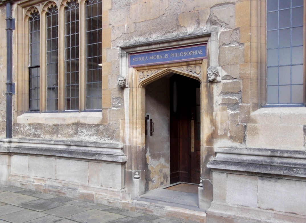
The collection moved from the Douce Room in 1887, into the Moral Philosophy School room in the Old Schools quadrangle. Fitted out at a cost of £480 this space was soon cramped and it wasn’t until the completion of the New Library in 1939, and with it a large purpose-built room on the east side of the building with storage areas set aside in the stacks on the same floor that the Map Department had finally a proper home.

17 December 2019

Unending.


The pursuit of knowing was freedom to me, the right to declare your own curiosities and follow them through all manner of books. I was made for the library, not the classroom. The classroom was a jail of other people’s interests. The library was open, unending, free.

Ta-Nehisi Coates

13 December 2017

Impressive.


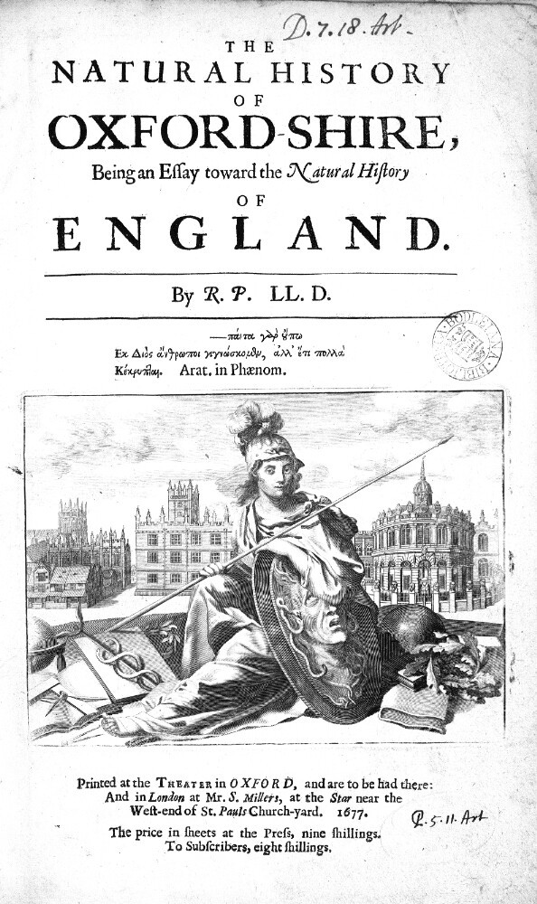
Robert Plot was born in December 1640 and baptized on 13 December, which many have quite reasonably taken to be his birthday. Plot lived a remarkable life, becoming first Keeper of the Ashmolean, Oxford’s first professor of Chemistry and the secretary of the Royal Society, and happily taking on the appellation of “the learned Dr. Plot.”

His book The Natural History of Oxford-shire of 1676, addressed to King Charles II, is almost as impressive as its author. Amongst its many noteworthy passages is the first known description of a dinosaur bone, though Plot did not know what exactly he was detailing.

Come we next to such as concern the Members of the Body: Amongst which, I have one dug out of a quarry in the Parish of Cornwell, and given me by the ingenious Sir Thomas Pennyston, that has exactly the Figure of the lowermost part of the Thigh-Bone of a Man or at least of some other Animal… 

CONNECT 


This is so neat!  The digitized volume is HERE.

30 July 2017

Respect.


You shall promise and swear in the presence of almightie God, that whensoever you shall repaire to the publique Librarie of this Universitie, you will conforme to your self to studie with modestie and silence, and use both the bookes and everything els appertaining to their furniture, with a careful respect to their longest conservation; and that neither yourself in person, nor any other whosoever, by your procurement or privitie, shall either openly or underhand, by way of embezeling, changing, razing, defacing, tearing, cutting, noting, interlining, or by voluntarie corrupting, blotting, slurring or any other manner of mangling, or misusing, any one or more of the saied bookes, either wholly or in part, make any alteration: but shall hinder and impeache, so much as lieth in yow, all and every offendour or offendours, by detecting their demeanour unto the Vice-chancellour, or to his Deputie then in place, within the next three daies after it shall com to your knowledge, so help you God by Christian merites, according to the doctrine of his holy Evangelistes.

Thomas Bodley’s Oath, pledged by all who were given a Reader’s Card for the Oxford University Bodleian Libraries.