"I am not one who was born in the custody of wisdom. I am one who is fond of olden times and intense in quest of the sacred knowing of the ancients." Gustave Courbet
Showing posts with label warfare. Show all posts

09 March 2025

Thick-Armored.


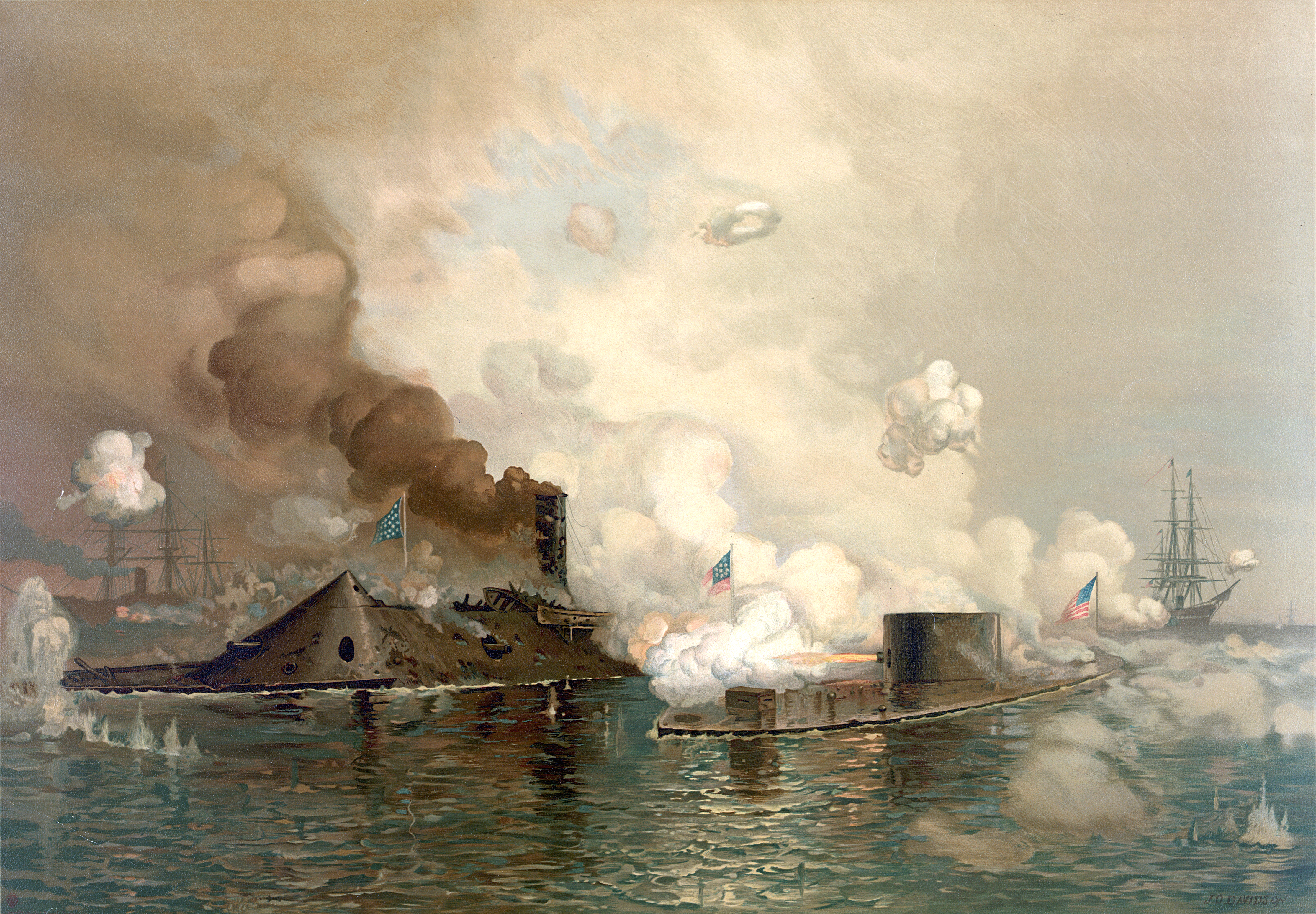
Right down the street from my sis' house, on this day in 1862, the Monitor and the Merrimack buttoned up and did battle on the Elizabeth River in Virginia.

American Battlefield Trust has the details ...
The CSS Virginia was fairly conventional. Built upon the hull of the USS Merrimac, it was a wooden vessel covered with iron plates, and it had fixed weapons. Still, she was a formidable threat. Iron covered, the ship measured 275 feet long 38.5 feet across its beam, and 27.5 feet deep. It was angled such that cannon shot would harmlessly bounce off its sides. Outfitted with ten guns and resembling a floating barn roof, the ship was rechristened the CSS Virginia and released from dry dock into the Elizabeth River on February 17, 1862.

The ship possessed a mixed armament consisting of two 7-in. Brooke rifles, two 6.4-in. Brooke rifles, six 9-in. Dahlgren smoothbores, as well as two 12-pdr howitzers. While the bulk of the guns were mounted in the ship's broadside, the two 7-in. Brooke rifles were mounted on pivots at the bow and stern and could traverse to fire from multiple gun ports. In creating the ship, the designers concluded that its guns would be unable to penetrate the armor of another ironclad. As a result, they had Virginia fitted with a large ram on the bow. Though a formidable vessel, Virginia's size and balky engines made it difficult to maneuver and complete circle required a mile of space and forty-five minutes. 

When federal authorities discovered in the summer of 1861 that the Confederates were armoring the old Merrimac, they knew they had to commission a unique vessel of their own to challenge her.  USS Monitor, was commissioned on February 25, 1862 at New York City, New York.   An innovative warship, she had a thick-armored round turret which was twenty-feet in diameter.  Rotated by steam power, the turret could fire nearly 360 degrees from a pair of eleven-inch Dahlgren smoothbore shell guns.

The Monitor had a round, rotating gun turret on her deck. The iron turret housed two Dahlgren guns, installed side by side. Innovative in design as well as in construction, the Monitor had components and attributes that were later echoed in submarine design. Her armored deck, 172 feet long and 41.5 feet at the beam, rode just 18 inches above the waterline and extended beyond the hull, which was only 5/8-inch thick and thus nearly submerged for protection against cannon fire. On the deck with the gun turret was a small pilothouse and a detachable smokestack. The turret was made from eight layers of 1-inch iron plate bolted together. A ninth plate within the turret provided a sound barrier.

17 June 2023

Spirited.

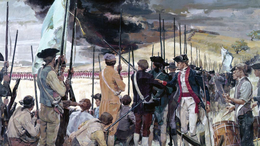
Riley, The Battle of Bunker Hill, N/d


The Battle of Bunker Hill was fought on this day in 1775.

As always, American Battlefield Trust nails it ...
On this sultry afternoon, Gage and his commanders order British regulars and grenadiers to move across Boston Harbor and disembark in lower Charlestown, where Gage will force the rabble’s hand with an assault. As the British move into position, the fatigued but spirited defenders are on the alert inside their hastily built fortifications.

Led by Gen. William Howe, King George’s troops climb Breed’s Hill in perfect battle formation. Legend has it that as they advance, American officer William Prescott cautions his men not to waste their powder, exclaiming “don’t fire until you see the whites of their eyes” ...

10 June 2023

Confident.


Forrest was confident, as always, despite the fact that the enemy held close to a two-to-one advantage in numbers and nearly three times as many guns. “I know they greatly outnumber the troops I have at hand,” he told Rucker, who rode with him in advance of his brigade, “but the road along which they will march is narrow and muddy; they will make slow progress. The country is densely wooded and the undergrowth so heavy that when we strike them they will not know how few men we have. Their cavalry will move out ahead of their infantry, and should reach the crossroads three hours in advance. We can whip their cavalry in that time. As soon as the fight opens they will send back to have the infantry hurried in. It is going to be hot as hell, and coming on the run for five or six miles, their infantry will be so tired out we will ride right over them.”

Don't miss the description of this battle in Chapter One of Confederate Wizards of the Saddle.

04 February 2023

Victory.

The History Channel's "Battle Stations" examines Nelson's legendary flagship HMS Victory ...

30 January 2023

Art.


Revolutionary War maps range from hasty sketches of roads and paths to elaborate topographical charts depicting elevations, roads, streams and buildings. They were created to support and document military operations as well as to inform the public about the course of the war. These ten reflect the variety of fine maps created during the Revolutionary War and are distinguished for their detail.

By the late eighteenth century, military mapmaking had become a fine art. European military engineers were trained as cartographers, and many used pen, ink and watercolor to produce extraordinary manuscript maps. The maps of British engineer Charles Blaskowitz and French engineer Michel Capitaine du Chesnoy are among the finest military maps ever created.

American engineers generally lacked the training to produce sophisticated maps. As in other aspects of the art of war, they imitated European models and grew more proficient. By the end of the war, Continental Army engineer Sebastian Bauman was able to create a map of the Siege of Yorktown comparable to the best British and French military maps. Immensely proud of his accomplishment, Bauman oversaw the engraving and publication of the map and its distribution to the American and French officers who purchased it. A pristine copy of the Bauman map is one of the special treasures of the American Revolution Institute.

02 July 2022

Ponder.


In great deeds, something abides. On great fields, something stays. Forms change and pass; bodies disappear; but spirits linger, to consecrate ground for the vision-place of souls  Generations that know us not and that we know not of, heart-drawn to see where and by whom great things were suffered and done for them, shall come to this deathless field, to ponder and dream; and lo! the shadow of a mighty presence shall wrap them in its bosom, and the power of the vision pass into their souls.

Joshua Lawrence Chamberlain, who directed the defense of Little Round Top during the battle of Gettysburg on this day in 1863

22 June 2022

Breathtaking.


Ed Offley on German U-Boats directly off the coast of Virginia Beach during World War Two ...
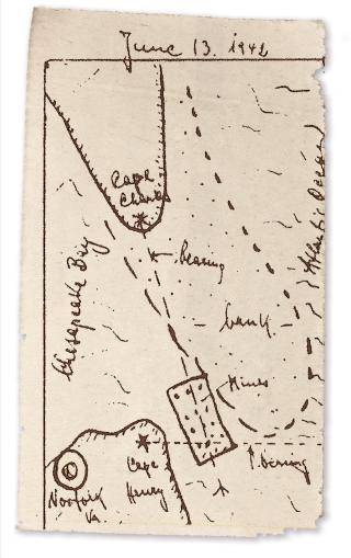
Earlier in the crossing, Degen, navigator Günter Kunert, and his two watch officers had spent hours studying a large nautical chart of the area. They concluded that the strict operational order that Dönitz and his staff had written would doom U-701 to failure and probable detection. “Our order directed us to go straight to the entrance of Chesapeake Bay; to dive there during the night and to observe during the day the exact ship traffic of incoming and outgoing ships,” Degen recalled. But the chart showed that this meant U-701 would have to hide in just 36 feet of water, leaving her conning tower just four feet below the surface.

Dismissing the order as “suicidal,” Degen opted to make a straight run-in to the channel after midnight. The lighthouses on Cape Henry and Cape Charles would make the move simple and relatively easy. U-701 slowly headed west toward the Virginia Beach oceanfront.

After an hour, Kunert called out that the two lighthouses were aligned, and Degen ordered a 90-degree turn to starboard, running just several hundred yards offshore. Five months earlier, U-boats in the first coastal attacks had been amazed to find shoreline streets on New York’s Long Island brightly lit; now, after hundreds of ships had gone down from U-boat torpedoes, Degen and his lookouts were seeing the same “breathtaking” sight along the Virginia shore. “We could see . . . even cars and people and lighted houses,” Degen would recall. “These Americans didn’t seem to know there was a war going on!”

As the Cape Henry lighthouse loomed up ahead to port, Degen gave the order to his torpedo compartment to prepare to drop the mines. The torpedo gang flooded the five torpedo tubes and released the locking bolt that anchored the foremost mine in each tube. Before he could order the first mine dropped, Degen and his lookouts stiffened as a small patrol boat appeared traveling right to left across the U-boat’s track just several hundred yards away. She reached the edge of the channel, then reversed course, unaware that she was practically on top of the U-boat.

Offley joins Proceedings Podcast host Eric Mills to discuss U-701 ...


Thanks, Buff.

14 August 2019

Carnyx.


In 1993 John Kenny became the first person in 2000 years to play the carnyx, a Celtic war horn and much more. His instrument, a faithful reconstruction of a carnyx found in Aberdeenshire, Scotland, in 1816, offers a fascinating insight into the musical archaeology of the iron age.


Brilliant.